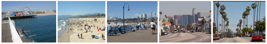
Transportation in LA
Public Transportation in LA
Frankly, public Transportation in LA is pitiful. I stated that on July 2003 and it has not improved much. If you're a traveller arriving at the airport (LAX) don't expect anyone there to be able to tell you how to get anywhere on public transportation. Sadly, no one can. Yes, even Traveller's Aide. If you're lucky you can find a bus driver who can help a bit, but that's a gamble. I add whatever I find out.
Even if you live in LA and spend hours searching for transit info and real-life maps, you'll meet many a dead-end. It makes me crazy.
Another site that may help: Transit Rider — transit-rider.com.
For SoCal, it provides links to all the transit. It also has some photos.
Transit Rider also covers Tijuana, Mexico, San Francisco, Denver, and more.
Another site is SubChat.com message boards, and BusChat message boards.
The Los Angeles Transit Rider home page.
The Metro area — Metro Transit Authority
When you're wondering if public transportation can get you from one place to another, and how long it will take, and what it will cost, use the Trip Planner. (Warning: frustrating. You'll may have to verify addresses even when you enter them correctly.) There is a lot of transit info at the MTA site, but I find it a frustrating site that lacks what I really need.
Here are some of the important links at that site:
- Metro Rail overview page — includes links to online maps that I specify below and provides info about riding the trains and about each line.
- Metro Maps jump-off page — Links to all maps. Lets see if this page stays in place.
- Full Metro Rail map — shows all lines. But sadly, these are strip maps, not street overlays so you have no clue where the trains actually let you off. (See, I told you it's a sad situation.)
- Blue Line runs north-south between Long Beach & Los Angeles.
If you're in Long Beach and want to go to the LA Convention Center, Staples Center, or see downtown LA, this is great. - Green Line runs east-west between Norwalk & Redondo Beach, curving south near LA Airport. Crosses the Blue Line.
- Red Line runs through Downtown, between Union Station, the Mid-Wilshire area, Hollywood and into the San Fernando Valley. Meets the Blue Line.
- Purple Line runs Mid-Wilshire, pretty much along Wilshire from Western to Union Station.
- Gold Line runs northeast to Pasadena. Connects with the Red Line at Union Station, which is the downtown LA station.
- Orange Line runs the San Fernando Valley, but it's a bus line, not train. I think it is meant to get you from the Valley to the North Hollywood train station and then onto the metro trains.
- Blue Line runs north-south between Long Beach & Los Angeles.
- Metro bus overview PDF — no online maps to give you a quick idea. Hard to use if you don't already know the area. (I've been in LA a decade and don't like trying to use them.) I recommend you right-click and choose to download this page, rather than click it.
Metro Day pass — official page
You can ride any Metro bus or rail line all day long for $5 (accurate 8/27/08). Four rides and you save money over the single-fares ($1.25). You can buy a Day Pass at on any Metro Bus or at any Metro Rail station.
Additional zone charges on freeway bus routes. Senior/Disabled/Medicare rate for Metro Day Pass is $1.80. Additional fee required to transfer to municipal bus lines.
You can buy other passes and tokens at (per their website) "Metro Customer Centers and more than 650 other locations (like check cashing places)."
Other LA area transport
- LADOT (LA Dept of Transit), including DASH.
- DASH direct link. Dash busses are short-run busses that focus within small areas. For example, one just goes around downtown and one goes thru Hollywood. Perfect for travellers. Just 25 cents (July 2003).
Other LA area city transport
There are also city-centric bus systems, which are not limited to service just within their cities. (For example, some will get you into LA to see the area, do business, or fly from LAX.)
- Santa Monica busses, aka The Big Blue Bus
Notice that Line 10 goes to Downtown LA. Great for a traveller staying at the Santa Monica Youth Hostel and wanting to see downtown. - Culver City busses, aka Culver CityBus
- VisitLongBeach.com has a page about Long Beach transit including bicycles, buses, and airlines. (Long Beach is about 20 miles south of LA. It's Blue Line rail connects to LA and so do busses, but it's not really travel in LA proper.)
- Torrance Transit (Torrance is another town just outside of what I'd call LA.) Their phone number is (800) COMMUTE.
Misc transport
- Ocean Express — a "trolley" bus from Century Blvd to Manhattan Beach. There is a link to Ocean Express info from this Gateway To LA page. If you're staying on Century Blvd, this may be a great way to see Manhatten Beach. It's free, running hourly from 11 am - 9 pm April-September, and noon - 8p, pm October - March. The first stop is near La Cienega and Century; there are 5 more on Century.
Automobile Transit in LA
Perhaps you've heard of LA's freeways. They were build with the idea that LA was a thoroughly modern city — one where personal transportation (the auto) was the way. In fact, that's why rail systems were removed. But no one anticipated LA's population explosion, so while freeways are free to ride, they're certainly not free of traffic jams — and neither are most main local streets.
Traffic information
- The California AAA Club's Traffic Information Center provides info on Traffic Incidents, SIG Alerts, and Construction, as reported by the California Highway Patrol (CHP) and Caltrans. Start at this page to choose your city or freeway.
- KFI radio Traffic reports.
- Here's the Travel Advisory News Network (TANN) LA Region Traffic Map, showing real time traffic from Santa Clarita to San Juan Capistrano to Big Bear.
- KNX 1070 AM radio reports current road conditions (and weather) every 6 minutes.
- KFWB 980 AM radio also reports the KNX info every 10 minutes.
- The government provides this road closure report.
 Freeway Service Patrol
Here's something cool that people do for you in LA!
As part of Proposition C (1990), there's a free Metro Freeway Service Patrol (FSP) — a special team of tow truck drivers patrolling over 400 miles of freeways all over Los Angeles County during the high traffic times to provide help if you get stranded and to remove traffic accidents. This is to help keep traffic flowing, but it's also great for us if we get stuck.
Free Metro FSP Services (they're not even allowed to take a tip):
• Change your flat tire
• Jump-starting your car
• Refill your radiators or tape a leaky hose
• Put a gallon of gas in your tank
• Tow you off the freeway if they cannot get you running quickly.
Fuel
If you're curious about the price of gas here, have fun at LosAngelesGasPrices.com.
Then there's CaliforniaGasPrices.com.
Airports in the LA area
There are several LA area airports
- The official website for LAX, Van Nuys, Ontario, Palmdale airports.
- The official website for Burbank's Bob Hope airport (BUR).
- The official website for Long Beach airport (LGB).
- The official website for Orange County's John Wayne airport (SNA).
- The official website for Torrance airport. (This is a small craft airport only.)
Getting to and from LAX Airport
Of course, any guide to LA will tell you about the shuttles and cabs you can take to or from LAX (our airport). But what about public transport? Well that's a good one. Forget asking Traveller's Aid at the airport; they have no clue. (I've tried several times over the years. Last time I tried was October 2003.) And there's little info and zero links at the LAX website.
They built a train line to LAX — but it stops before the airport. It's Metro Rail Green Line and the stop is Aviation Station. From there you take the free shuttle service to and from LAX.
There are busses — but they are not allowed into the airport. (This is not a 9-11 thing.) So what can you do? If you can get to Van Nuys you can take their well-priced Van Nuys FlyAway buses.
The LAX website has info about public transport under their Ground Transportation link and parking info under the Parking link. (The site is done in frames and does not properly put you in the frameset so you need to go to the main page, then click the buttons.) Basically, you wait under the LAX Shuttle & Airline Connections sign on the Arrival (lower) Level "islands" that are in front of each terminal and take either the board the G or C shuttle busses. G goes to the Metro Rail Green Line's Aviation Station. C goes to the Los Angeles County Metropolitan Transportation Authority Bus Center.
LosAngelesAreaLife.com
In addition to this Los Angeles section, I have an entire website, called LosAngelesAreaLife.com.